Egyptian Geography and environment
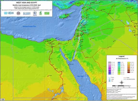
Egypt's Average Air Temperature for April
This physical regions map shows Egypt's average air temperature in April. Egypt's temperature ranges from 15 - 35 degrees Celsius depending on location within the country.
Retrieved from: http://geonet.icarda.cgiar.org/geonetwork/data/regional/West_Asia/Maps/Tmean/JPG/Map122Monthly-mean-temperature-2010-2040,-GHG-scenarioA2April.jpg
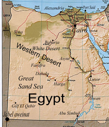
Egyptian Mountain Ranges and River Systems
This map is an example of a physical region of Egypt. It depicts where all of the mountain ranges and river systems are throughout the country. Throughout Egypt many mountain ranges and river systems can be found. These are both necessary to the country's survival and growth.
Retrieved from:
http://www.desertecotours.com/UploadImg/Mapot/map_of_western.jpg
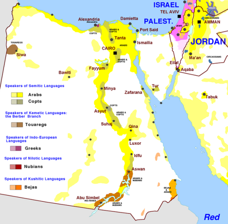
Map of Egypt's Cultural Regions
This cultural regions map shows where all of the different ethnic groups reside throughout Egypt. Each group is color coded, showing exactly which groups live where and how large of an area they occupy.
Retrieved from:
http://nealrauhauser.files.wordpress.com/2013/07/egypt-ethnolinguistic.png?w=625&h=613
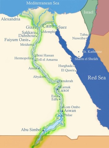
Map of the Nile River
The Nile River is the center of civilization for the people living in Egypt. It provides food, water, transportation, and protection. This map is a good representation of all of the factors that the Nile has to offer; the Fertile Crescent is shown as well as all of the main cities that are settled along the edge of the river.
Retrieved from:
http://www.min-travel.com/images/egypt_map_01.jpg
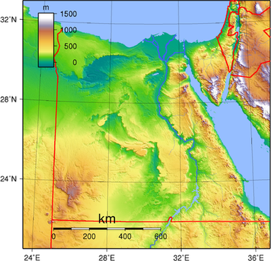
Topography Map of Egypt
This map shows the topography of Egypt. It is a physical example of the theme place. From this map you can see that Egypt's physical features do not range very high in most parts of the country.
Retrieved from: http://upload.wikimedia.org/wikipedia/commons/8/8b/Egypt_Topography.png
This map shows the topography of Egypt. It is a physical example of the theme place. From this map you can see that Egypt's physical features do not range very high in most parts of the country.
Retrieved from: http://upload.wikimedia.org/wikipedia/commons/8/8b/Egypt_Topography.png
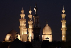
Mosques are large part of religion in Egypt. They are a place of worship throughout Egypt for those of the Muslim faith. This mosque is in Cairo, Egypt and is a human example of the theme place.
Retrieved from:
http://upload.wikimedia.org/wikipedia/commons/2/21/Cairo_mosques.jpg
Retrieved from:
http://upload.wikimedia.org/wikipedia/commons/2/21/Cairo_mosques.jpg
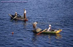
This photograph is an example of a human characteristic, it shows the transportation and communication system in Egypt. Since the earliest settlements in Egypt, the Nile River has been used to transport goods and people, as well as a means of communication with other cities and civilizations to trade and deliver messages.
Retrieved from:
http://ancientegyptmoberly.pbworks.com/f/nile%20river%20pic%20456.jpg
Retrieved from:
http://ancientegyptmoberly.pbworks.com/f/nile%20river%20pic%20456.jpg
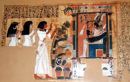
This piece of artwork was created by the Egyptians and it is an example of the ancient cultural features still found in modern day Egypt. It is also an example of a human characteristic that defines Egypt. The artwork is a form of literature that expressed the ancient Egyptian's religion as well as their lifestyle.
Retrieved from: http://upload.wikimedia.org/wikipedia/commons/3/32/Egypt_bookofthedead.jpg
Retrieved from: http://upload.wikimedia.org/wikipedia/commons/3/32/Egypt_bookofthedead.jpg
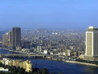
Here is a picture of Cairo, an Egyptian city. This image is an example of both a physical and human characteristic. The city was built by Egyptians making it a human characteristic, but the natural habitat and river that surrounds the city in this picture is an example of a physical characteristic.
Retrieved from:
http://www.worldexecutive.com/cityguides/pics/cairo/cairo_1.jpg
Retrieved from:
http://www.worldexecutive.com/cityguides/pics/cairo/cairo_1.jpg
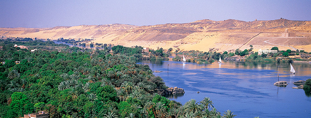
This picture is an example of a physical characteristic. Along the Nile River there is a lush, green landscape. The landscape is what makes up Egypt's physical characteristics.
Retrieved from:
http://www.ask-aladdin.com/blog/wp-content/uploads/2013/11/NileRiver1.jpg
Retrieved from:
http://www.ask-aladdin.com/blog/wp-content/uploads/2013/11/NileRiver1.jpg
